Kartta
Buildien karttaominaisuuden avulla seuraat hankkeesi etenemistä selkeästi ja reaaliaikaisesti. Näet heti, missä työvaiheet tapahtuvat ja miten projekti etenee maantieteellisesti.
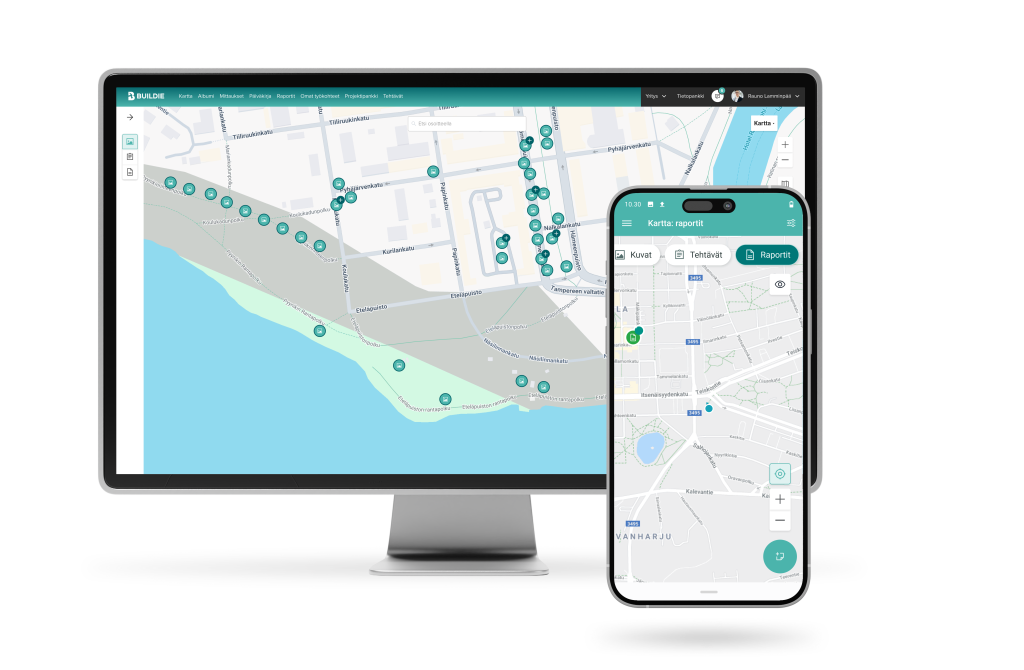
Seuraa hankkeiden etenemistä reaaliaikaisesti ja selkeästi
Karttanäkymän avulla löydät ympäri kaupungin tehdyt kunnossapitotöiden dokumentit ja tehtävien ajantasaisen tilanteen. Investointihankkeella saat kartan avulla seurattua etenemää vaivattomasti ja löydettyä tarvitun materiaalin.
Helpottaa laajojen alueiden työtehtävien koordinointia
Parantaa kentällä tuotettujen tietojen etsimistä ja hallintaa
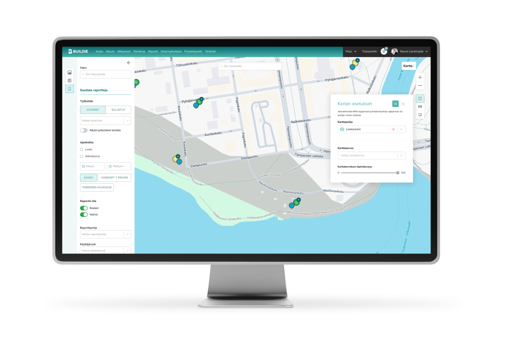
Mahdollistaa paikkaan sidotun laatuaineiston valvonnan
Nopeuttaa työvaiheiden ja havaintojen seurantaa
Miksi valita Buildien kartta?
Voit helposti löytää tietyssä sijainnissa otetut ja tehdyt kuvat, tehtävät ja raportit. Tämä nopeuttaa dokumentointia ja auttaa valvomaan hankkeen riskikohtia tarkasti.
- Reaaliaikainen näkymä hankkeen etenemiseen karttapohjaisesti
- Paikkasidottu dokumentointi helpottaa tiedonhallintaa ja laadunvalvontaa
- Tehokkaampi tiedon etsintä ja hallinta, jolloin projektin kokonaiskuva pysyy selkeänä
WMS-karttapohjat
Buildien avulla voit käyttää Web Map Service (WMS) -karttapohjia, joiden kautta ulkoiset paikkatietoaineistot ovat helposti hyödynnettävissä karttanäkymässä.
WFS-karttapohjat
Buildie tukee Web Feature Service (WFS) -karttapohjia, joiden interaktiivinen toiminnallisuus mahdollistaa tarkemman sijaintitiedon hyödyntämisen.
Sinua saattaisi kiinnostaa myös
Tutustu tarkemmin Buildien tarjoamiin mahdollisuuksiin. Sivuiltamme löydät niin asiakastarinoita kuin tuotteen keskeisiä ominaisuuksia ja käytännön esimerkkejäkin.
Valokuvausdokumentointi

Tehtävienhallinta
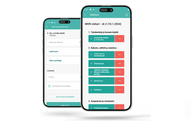
Uuden sukupolven turvallisuusmittaus
Työmaan turvallisuus on aina etusijalla, ja Buildien uusi MVR-mittaus tekee turvallisuuden hallinnasta tarkempaa ja tehokkaampaa kuin koskaan ennen.