Kumppanit ja integraatiot
Buildie tekee yhteistyötä alan johtavien toimijoiden kanssa tarjotakseen asiakkailleen tehokkaimmat ratkaisut ja saumattomat integraatiot. Tutustu kumppaneihimme ja siihen, kuinka he voivat tehostaa sinun työmaasi toimintaa.
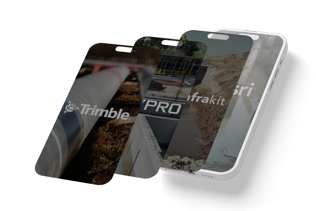
Infrakit
- Reaaliaikainen tiedonkulku, helppo dokumentointi ja parempi projektin seuranta
- Buildie-käyttäjille tulee työkohteiden projektipankkiin Infrakit-kansio, johon Infrakitissä olevat vastaavien työkohteiden projektipankkitiedot siirtyvät automaattisesti
- Rajapinta tehostaa, sujuvoittaa ja nopeuttaa infrahankkeiden projektidokumentointia. Buildiessa olevalle Infrakit-kansiolle on mahdollista antaa käyttöoikeudet samalla tavalla kuin muillekkin projektipankin kansioille
- Integraatio mahdollistaa entistä kattavamman dokumentoinnin saumattoman tiedonsiirron ansiosta
Trimble NIS
- Buildie ja Trimble NIS ovat toteuttaneet rajapinnan, joka mahdollistaa Buildiellä tehtyjen valokuvadokumentaatioiden lähettämisen suoraan Trimble NIS:iin
- Lähetetyissä kuvissa säilyvät käyttäjän nimitiedot, työkohdetiedot, aikaleima, kuvateksti, työvaiheet sekä GPS-koordinaatit
- Tiedot ovat tarkasteltavissa sekä Trimble NIS:issä että Utility To Go -mobiilisovelluksessa
- Muuttumaton: Integraatio mahdollistaa entistä kattavamman dokumentoinnin saumattoman tiedonsiirron ansiosta
KeyPro
- Buildie ja KeyAqua ovat toteuttaneet rajapinnan, joka mahdollistaa Buildiellä tehdyn valokuvadokumentaation lähettämisen KeyAquaan
- Lähetetyissä kuvissa säilyvät käyttäjän nimitiedot, työkohdetiedot, aikaleima, kuvateksti, työvaiheet ja GPS-koordinaatit. Tiedot ovat tarkasteltavissa myös KeyAquasta käsin
- Rajapinta on saatavissa kaikkiin Keypron tuoteperheen sovelluksiin
Esri
- Buildien ja Esrin rajapinnan avulla paikkatieto saadaan yhdistettyä suoraan työmaiden dokumentointiin ja laadunvarmistukseen
- Työkohteiden linkitys: Voit yhdistää minkä tahansa työkohteen ESRI-järjestelmään
- Automaattinen kuvansiirto: Valitse haluamasi työvaiheet, joilta kuvat siirtyvät automaattisesti ESRIin
- Manuaalinen kuvansiirto: Siirrä valokuvia manuaalisesti suoraan albumista ESRI-järjestelmään
InfraWeb
- Buildien laatudokumentaatio (valokuvat, päiväkirjat, tehtävät, lomakkeet) siirtyvät automaattisesti InfraWEBin omaisuudenhallintaan
- Tiedot linkittyvät verkosto-omaisuuteen GPS koordinaattien, aikaleiman ja käyttäjätietojen avulla
- Integraatio rikastaa InfraWEB palveluita ja tehostaa kunnossapidon tiedolla johtamista
- Integraatio mahdollistaa entistä kattavamman dokumentoinnin saumattoman tiedonsiirron ansiosta
Sinua saattaisi kiinnostaa myös
Tutustu tarkemmin Buildien tarjoamiin mahdollisuuksiin. Sivuiltamme löydät niin asiakastarinoita kuin tuotteen keskeisiä ominaisuuksia ja käytännön esimerkkejäkin.
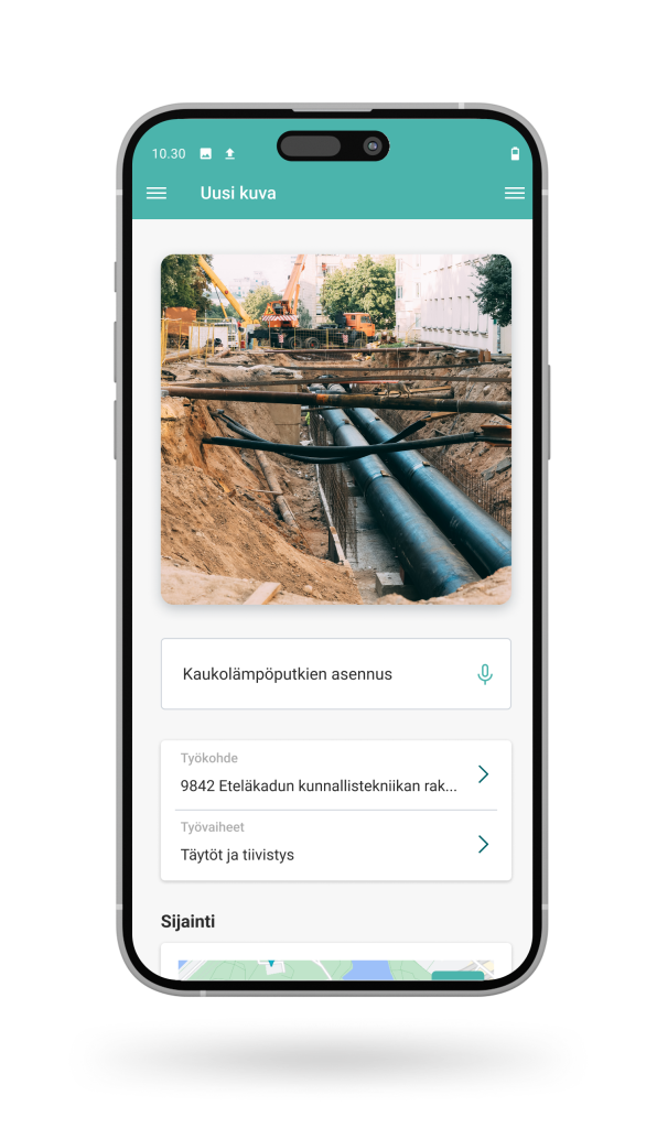
Valokuvausdokumentointi
Buildien älykäs valokuvaus mahdollistaa rakentamisen systemaattisen dokumentoinnin. Helppokäyttöinen sovellus sopii jokaisen käteen työmaalla ja kerää aineiston automaattisesti yhteen päivittäistä seurantaa ja hankkeen laatuaineistoa varten.

Tehtävienhallinta
Buildien tehtävienhallinta tarjoaa helppokäyttöisen ratkaisun työmaan päivittäisten tehtävien hallintaan ja seurantaan. Sovelluksen avulla voit ohjata työtehtävät työntekijöille nopeasti ja varmistaa, että työ hoituu selkeästi ja dokumentoidusti – ilman turhia viestejä, paperilappuja tai epäselviä ohjeita.
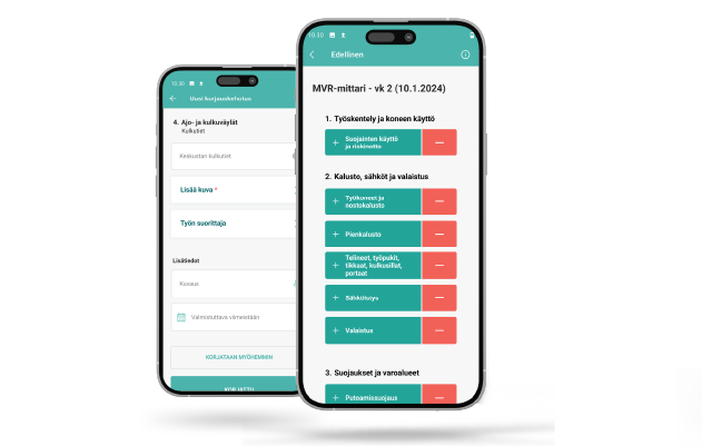
Uuden sukupolven turvallisuusmittaus
Työmaan turvallisuus on aina etusijalla, ja Buildien uusi MVR-mittaus tekee turvallisuuden hallinnasta tarkempaa ja tehokkaampaa kuin koskaan ennen.